Mapping the potential of geothermal energy
ThermoGIS is a public, web-based geographic information system that displays the regional potential of geothermal energy and high temperature aquifer thermal energy storage (HT-ATES) in the Netherlands.
The platform supports businesses and public authorities in identifying promising areas for geothermal energy extraction and determining suitable locations for HT-ATES in the Dutch subsurface. ThermoGIS was developed by and is part of TNO Geological Survey of the Netherlands (TNO-GDN).

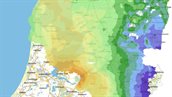
Map viewer
Take a look at the interactive maps showing the potential for geothermal energy and heat storage in the Netherlands.

About ThermoGIS
ThermoGIS maps the potential of geothermal energy and HTO.
News